2009 Sierra ExpeditionMammoth to McGee Creek
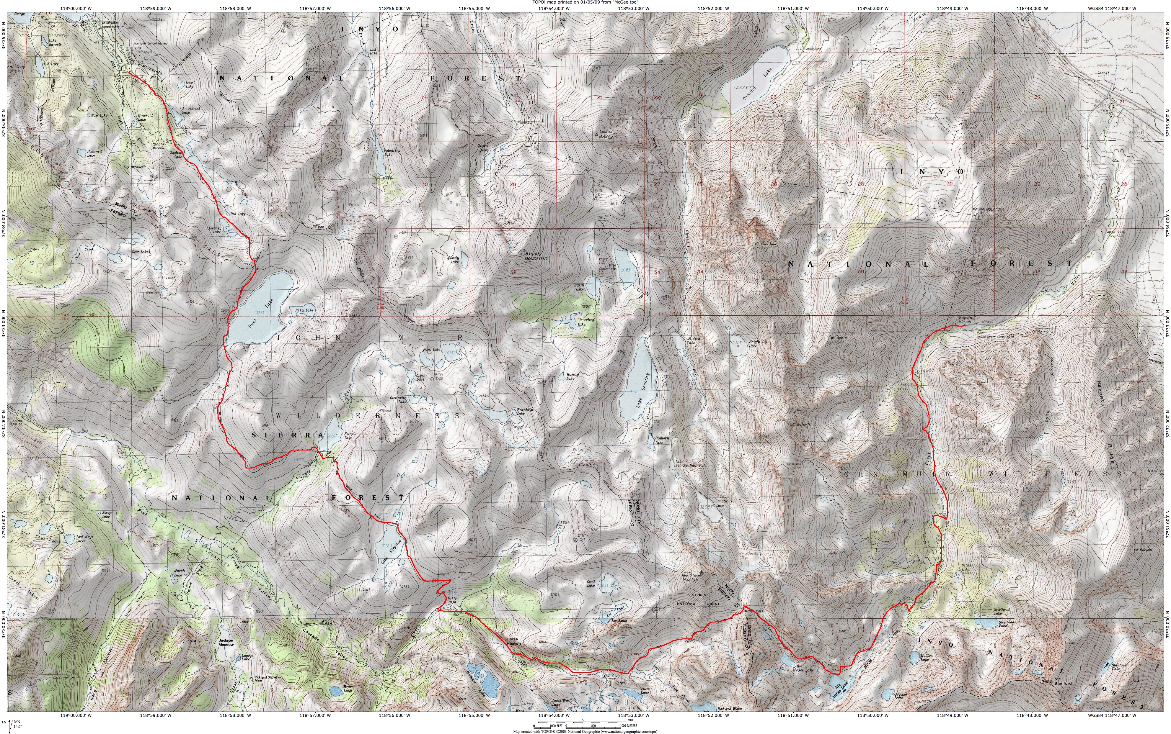
The destination this year is the beautiful area south of Mammoth Lakes. We'll start at Mammoth Lakes, being packed in the first day as usual. After that, we'll meander through some spectacular country before leaving through McGee Canyon (unless we head out the way we came). The planned hike is about 30 miles. It looks like snowfall for the season will be under the average (bad news for California), so we'll go with the early date. As of April 1, snowfall in the Southern Sierra was 78% of average. That means the bugs will be dead by the time we get there. August 1 (Saturday): Given the number of new expedition members, I'd like to spend a day in Mammoth Lakes (at 8,000 feet) to help acclimate people. We'll fly to Las Vegas and Drive to Mammoth. I've reserved a condo that will sleep us all at a reasonable price. August 2 (Sunday) : Mammoth Lakes. I have a batch of favorite day hikes in the area. My favorite is the Gaylor Lakes area, above Tioga Pass, the entrance to Yosemite National Park, which easily takes us up to about 10,400 feet, and a lovely lake basin. August 3 (Monday): We'll hike about 10 miles from Lake Mary (9055') over Duck Pass (10,797') to Purple Lake (9,928'), with our packs being hauled in by the Mammoth Lakes Pack Station. Campfires are permitted at Purple Lake. August 4 (Tuesday): Layover day at Purple Lake. August 5 (Wednesday): Hike about 6 miles through Tully Hole to Horse Heaven (around 9800'). Campfires permitted. August 6 (Thursday): Layover day at Horse Heaven. There are lots of interesting day hikes from here. August 7 (Friday): Hike about 6 miles over McGee Pass (11,876') to Big McGee Lake (10,600'). No campfires allowed. Alternatively, we could head back toward Mammoth, which would save the trouble of getting back to the car. We'd either return to Purple Lake, or find another site along the way. August 8 (Saturday): Hike out about 7 miles to the McGee Pass trailhead. August 9 (Sunday): Fly back to Grand Rapids. Links: A report on the planned hike in reverse. A panorama of Purple Lake, our campsite for two nights. A rough map of our route. If you use Google Earth, enter "Mammoth Lakes, CA," then move south, and you'll be over the area. Confirmed Participants:
For those who stumble across this page through a search engine, it's the planning page for a hiking group in Michigan. It is maintained by Randall Bytwerk (bytw2calvin.edu — replace the "2" with a "@"). |